
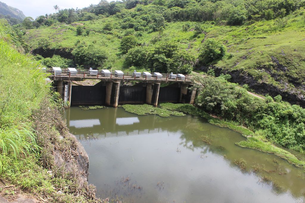
| Dam/Weir: KALLAR | |||
| Location | Latitude : 9⁰ 49′ 30 ” N Longitude: 77⁰ 09′ 20” E | Dam Features | |
| Type of Dam | Concrete- Gravity | ||
| Panchayath | Nedumkandam | Classification | LH ( Low height) |
| Village | Kalkoonthal | Maximum Water Level (MWL) | 824.48 m |
| District | Idukki | Full Reservoir Level ( FRL) | 824.48 m |
| River Basin | Periyar | Storage at FRL | 0.793 Mm3 |
| River | Perinjamkutty ( Tributary of Periyar) | Height from deepest foundation | 12.19 m |
| Release from Dam to river | Periyar | Length | 57.91 m |
| Taluk through which release flows | Thodupuzha, Udupanchola, Devikulam, Kothamangalam, Muvattupuzha, Kunnathunadu, Aluva, Kodungalloor, Paravur | Spillway | Ogee type – 4 Nos. Radial gates, each of size 7.62 x 6.10 m |
| Year of completion | 1975 | Crest Level | 818.38 m |
| Name of Project | Idukki HEP | River Outlet | No outlet |
| Type of Project | Hydro Power | Officers in charge & phone No. | Executive Engineer, Dam Safety Division No. II, Vazhathope, Idukki (Dist.), Kerala, PIN- 685602 Phone- 9446008425 |
| Installed capacity of the Project | 780 MW | Assistant Executive Engineer, Dam Safety Sub Division, Vazhathope , Idukki ( Dist.), Kerala , PNI-685602 Phone-9496011961 | |
| Project Identification Code ( PIC) | KL12HH0057 |
KALLAR DAM