
| Location | Latitude : 9⁰ 48′ 35 ” N Longitude: 77⁰ 06′ 20” E | Dam Features | |
| Type of Dam | Concrete- Gravity | ||
| Panchayath | Erattayar | Classification | MH ( Medium Height) |
| Village | Erattayar | Maximum Water Level (MWL) | EL 754.38 m |
| District | Idukki | Full Reservoir Level ( FRL) | EL 754.38 m |
| River Basin | Periyar | Storage at FRL | 5.352 Mm3 |
| River | Perinjamkutty ( Tributory of Periyar) | Height from deepest foundation | 19.81 m |
| Release from Dam to river | Erattayar | Length | 146.3 m |
| Taluk through which release flows | Thodupuzha, Udupanchola, Devikulam, Kothamangalam, Muvattupuzha, Kunnathunadu, Aluva, Kodungalloor, Paravur | Spillway | Ogee type – 2 Nos. Radial gates, each of size 7.62 x 6.10 m |
| Year of completion | 1975 | Crest Level | 748.28 m |
| Name of Project | Idukki HEP | River Outlet | 1 No. vertical lift type, 2.44 x 1.83 m |
| Purpose of Project | Hydro Power | Officers in charge & phone No. | Executive Engineer, Dam Safety Division No. II, Vazhathope, Idukki (Dist.), Kerala, PIN- 685602 Phone- 9446008425 |
| Installed capacity of the Project | 780 MW | Assistant Executive Engineer, Dam Safety Sub Division, Vazhathope , Idukki ( Dist.), Kerala , PNI-685602 Phone-9496011961 | |
| Project Identification Code ( PIC) | KL29MH0038 |
Idukki HE Project- Stage III- Kallar-Erattayar diversion scheme envisages creation of two forebays by means of diversion dams, one in river Kallar of storage capacity 28 Mcft.( 0.793 MCM) and another in river Erattayar of storage capacity 189 Mcft. (5.352 MCM) in the upper reaches of river Perinjamkutty a tributary of Periyar. Water from Kallar is diverted to Erattayar through a tunnel 2735.58 m long. Diversion of water from Erattayar forebay to Idukki reservoir is through another tunnel 3771.9m long.
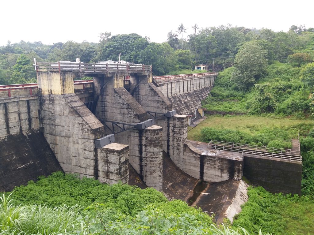
Erattayar